


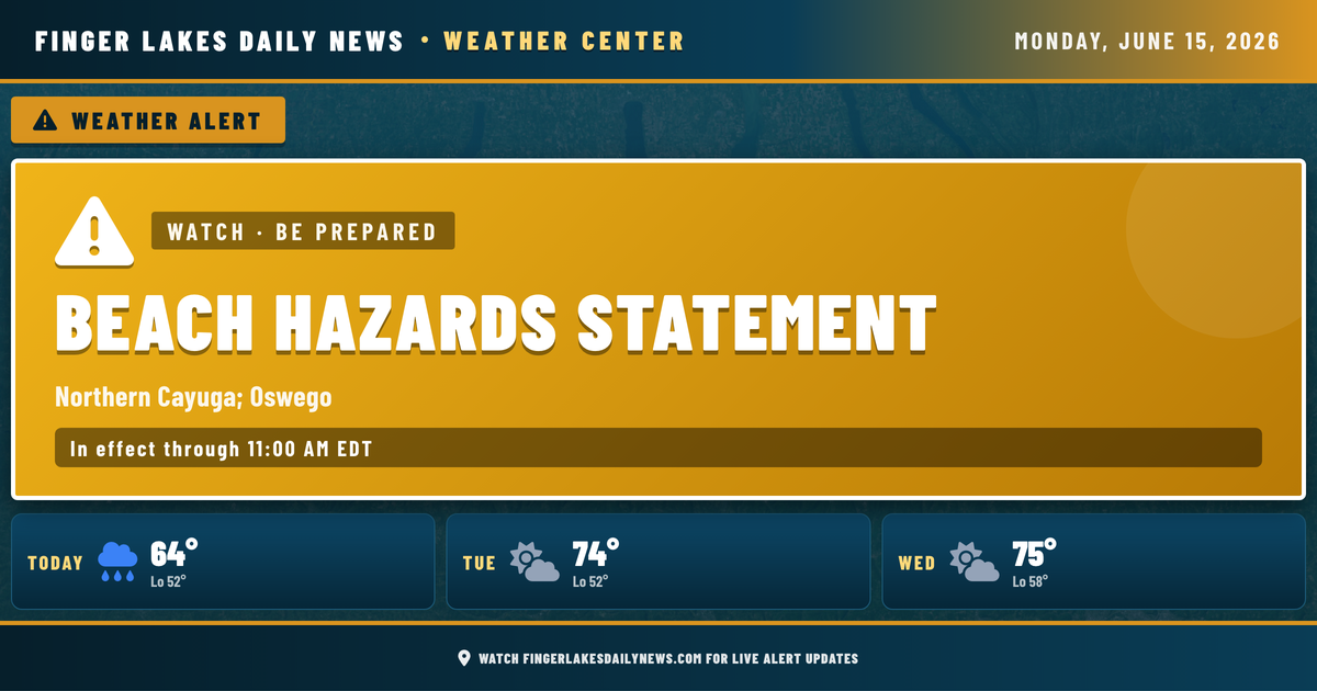
My eye this morning is on what’s missing rather than what’s here — the humidity, the cloud cover, the threat of rain — all of it pulled out with the passage of last night’s front, leaving a genuinely crisp June Monday across the Finger Lakes. At 6 AM, Geneva is sitting at 52°F under clear skies with a westerly breeze at 10 mph, and the rest of the region is right in line with it.
High pressure is building in behind that frontal passage, and 850-millibar temperatures have dipped enough to keep today notably cooler than we’ve seen in recent days. Expect highs in the low-to-mid 60s across the region — Geneva and Canandaigua near 64°, Ithaca and Corning approaching 67°. The lingering northwest flow could produce a few upslope clouds over the higher terrain through mid-morning, but that should break apart as the day goes on. Afternoon skies will be largely sunny with low humidity — about as pleasant a mid-June day as you’re going to get.
Evening temperatures fall back quickly under clear skies. Lows will return to the low 50s regionwide, with Corning and Bath — already at 50° this morning — dipping to near 50° again overnight. Tuesday brings a partial rebound toward the mid-70s, though an isolated shower or thunderstorm can’t be fully ruled out as a weak system tracks southeast across the Great Lakes.
The bigger story develops Wednesday night: a more organized round of showers and thunderstorms is expected to push through the region and continue into Thursday. The NWS is flagging a potential for some strong, gusty winds with that system — something worth watching as the week progresses. Thursday’s setup calls for highs near 79° with a 72% precipitation chance — that’s the peak of the unsettled stretch. Friday and into the weekend, conditions gradually improve, with mainly clear skies and highs in the low 70s expected by Saturday and Sunday.
Weather Center forecast for the Finger Lakes region. Sourced from NWS, Open-Meteo, NWS Area Forecast Discussion, and USGS stream-flow data. Updated 6 AM, noon, and 6 PM ET.