


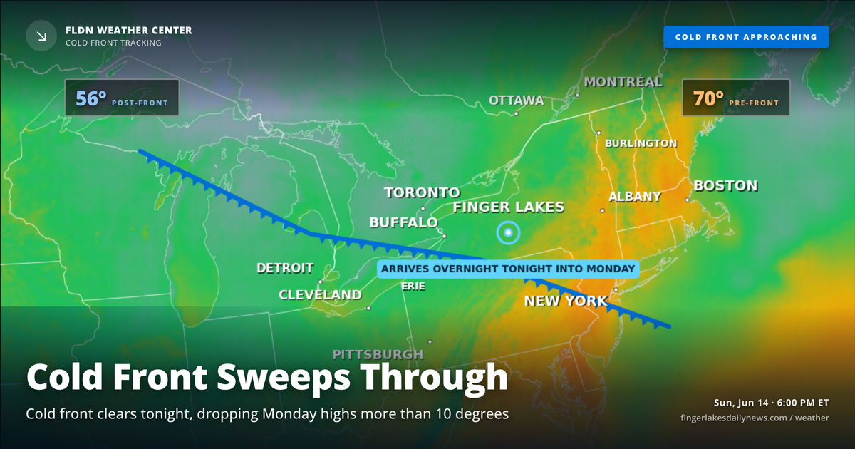
The cold front that’s been driving today’s rain is still pushing through as of 6 PM — Geneva is sitting at 73° under moderate rain, and the northwest wind shift tells you the front has already crossed the lake. The system, tracking off a low over northern Ontario, brought a line of storms into the region between 3 and 5 PM with the potential for gusty winds and locally heavy rainfall. NWS Buffalo had flagged a Slight Risk for severe weather through this evening, with the primary concern being damaging wind gusts rather than significant hail.
Rain totals from today’s activity should be manageable for most of the region. Stream gauges aren’t showing any alarm — Seneca River near Seneca Falls is elevated at 5.85 feet, but well within normal range for this time of year.
Overnight, rain chances diminish steadily as the front clears east. Skies partially clear before dawn, and lows settle into the low 60s for most of the region — near 61° in Geneva, 60° in Canandaigua. No frost concerns tonight.
Monday brings a noticeable change: dry air returns, highs only climb to around 66° in Geneva — a 13-degree drop from today’s high. Expect partly to mostly cloudy skies and a breeze out of the northwest around 10 to 12 mph. Mid-week a new chance of drizzle returns Wednesday, with a wetter pattern developing by Thursday.
Weather Center forecast for the Finger Lakes region. Sourced from NWS, Open-Meteo, NWS Area Forecast Discussion, and USGS stream-flow data. Updated 6 AM, noon, and 6 PM ET.