


Thirty-six hours from now, the Finger Lakes could be dealing with the season’s most significant severe weather setup — so this gorgeous Saturday afternoon is worth savoring while it lasts. Clear skies and a comfortable westerly breeze have temperatures climbing into the low 80s at midday, with Ithaca and Watkins Glen already at 82° and heading toward highs in the upper 80s by mid-afternoon.
No NWS alerts are currently active. The afternoon stays dry and pleasant throughout the region, with highs reaching 84° in Geneva and Auburn, 86° in Corning and Elmira, and upper 80s likely in the southern valleys. Evening looks just as nice — skies stay clear through sunset at 8:47 PM, with temperatures easing back through the 70s. Overnight lows settle near 61° in Geneva.
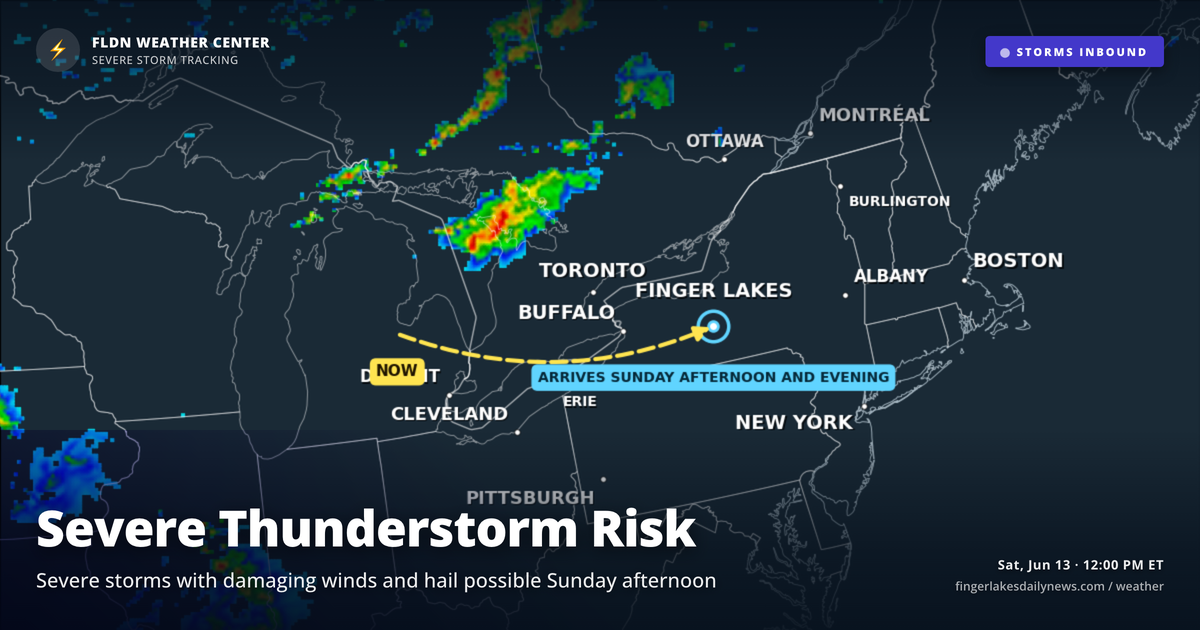
Sunday is the concern. A cold front sweeping in from the Great Lakes will drive widespread showers and thunderstorms into the region Sunday afternoon and evening. The NWS Buffalo office has flagged an elevated severe threat, with damaging winds and hail the primary hazards — instability and wind shear values both support organized storms. Conditions drop sharply on the back side: Monday brings dense drizzle and highs only in the upper 60s.
Weather Center forecast for the Finger Lakes region. Sourced from NWS, Open-Meteo, NWS Area Forecast Discussion, and USGS stream-flow data. Updated 6 AM, noon, and 6 PM ET.