


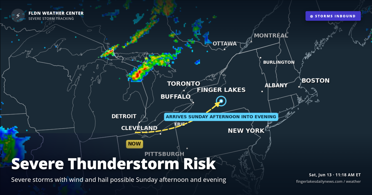
I’m watching Sunday’s setup closely — the National Weather Service in Buffalo has flagged an increased severe weather risk, and tonight’s beautiful finish to Saturday should not lull anyone into a false sense of security heading into tomorrow. Tonight will be fine: clear skies, lows settling to around 58°F regionwide, no frost threat, no precipitation. Enjoy it.
The story is Sunday. A cold front dropping out of the Great Lakes will push a wave of showers and thunderstorms through the Finger Lakes Sunday afternoon and evening. Buffalo forecasters are highlighting damaging winds and large hail as the primary threats. Moisture return ahead of the front will be substantial, and daytime heating Sunday will add instability — ingredients that can support strong to severe storms, particularly inland from the lakes. Canandaigua and Geneva sit squarely in that favored inland corridor.
Behind the front, Monday turns cooler and unsettled, with highs near 68°F and lingering shower chances.
Weather Center forecast for the Finger Lakes region. Sourced from NWS, Open-Meteo, NWS Area Forecast Discussion, and USGS stream-flow data. Updated 6 AM, noon, and 6 PM ET.