


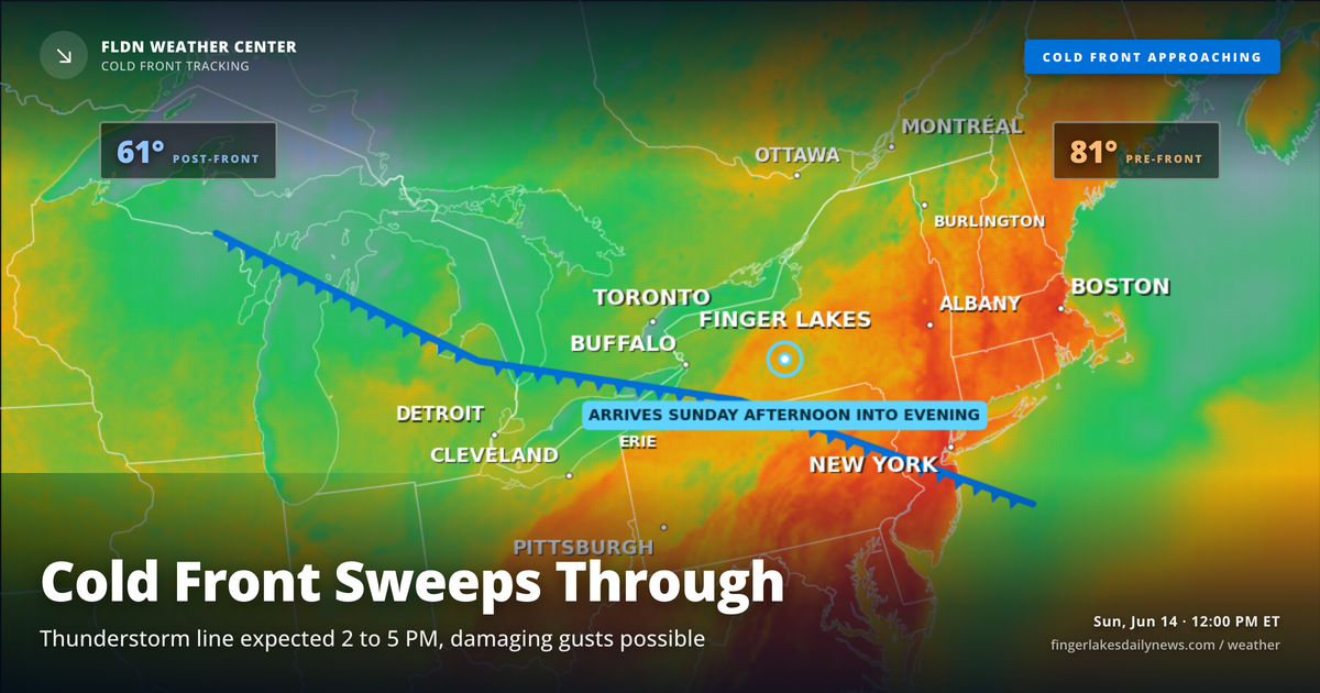
Canandaigua is already seeing light drizzle at noon — a preview of what’s building to the west. The morning’s scattered activity is the appetizer; the main event arrives this afternoon when a cold front pushing southeast from northern Ontario brings a line of showers and thunderstorms into the region, most likely between 2 and 5 PM.
The Storm Prediction Center has the Finger Lakes in a marginal to slight risk for severe weather, with damaging wind gusts the primary concern. Thunderstorm ingredients aren’t exceptional — instability is modest — but wind shear is strong enough that any organized storm could punch above its weight. Heavy rainfall is also possible in a short window.
Highs top out around 80 to 86°, with Ithaca and Watkins Glen warmest this afternoon before the front sweeps through. Once the line passes, skies clear overnight and Monday arrives noticeably cooler, with highs only in the mid-60s and much lower humidity.
Weather Center forecast for the Finger Lakes region. Sourced from NWS, Open-Meteo, NWS Area Forecast Discussion, and USGS stream-flow data. Updated 6 AM, noon, and 6 PM ET.