


I’m keeping a close eye on this weekend’s setup, because what starts as one of the nicest stretches of early June we’ve seen could end with a pretty active Saturday. But let’s not get ahead of ourselves — today is genuinely beautiful, and readers should enjoy it.
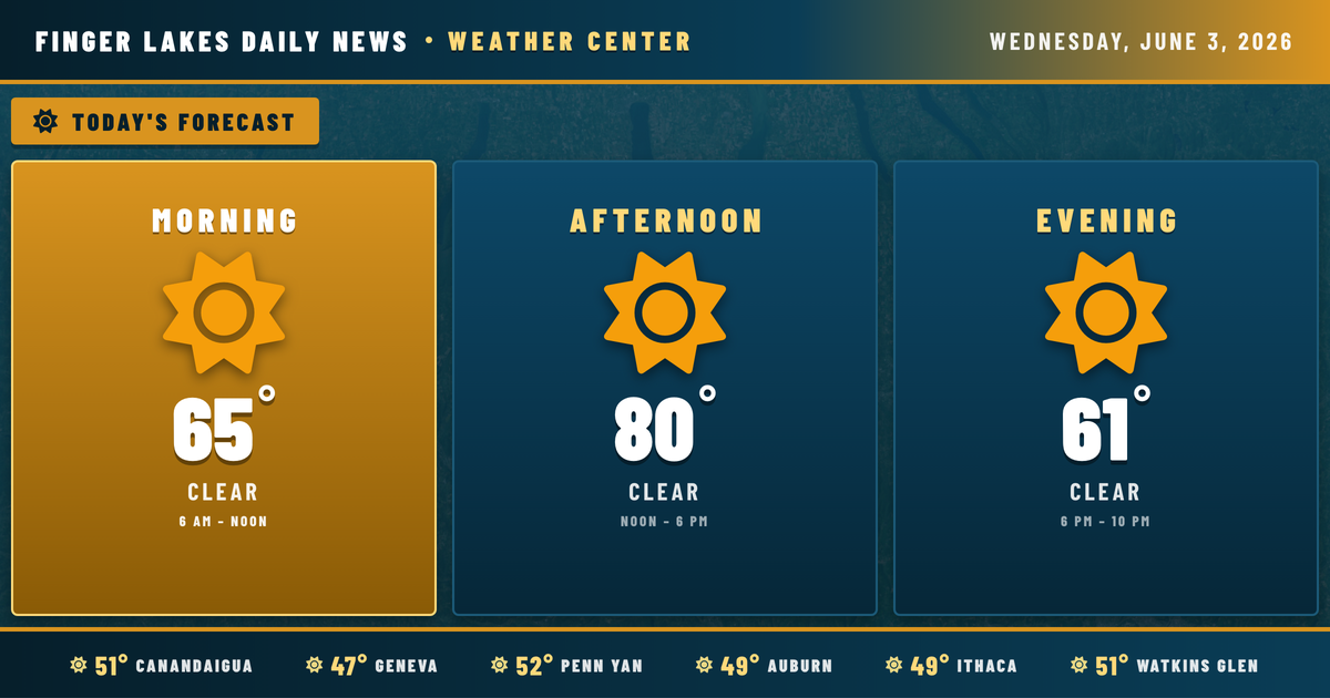
This morning is cool and clear across the region, with temperatures in the upper 40s to low 50s under calm winds. Skies stay clear all day as high pressure holds firm. Afternoon highs climb to near 80° in Geneva and Canandaigua, 79° in Ithaca, and 77° in Auburn — comfortable, sunny, and dry. Humidity stays low through the afternoon, making it feel excellent despite the warmth. Expect a light southerly breeze of around 5 to 9 mph. Evening cools pleasantly, with temperatures dropping back through the 60s after sunset at 8:41 PM. Overnight lows settle into the upper 40s regionwide.
Thursday brings more of the same, but warmer — highs pushing to 85° in Geneva as the ridge builds to its peak. Clouds begin to fill in Friday as a Pacific trough starts cresting the omega ridge pattern that’s been locked over the Northeast. The NWS Buffalo office notes increasing moisture and instability building through the weekend, with Saturday afternoon through Sunday morning the most likely window for showers and thunderstorms. Some of those storms could produce brief downpours.
Looking ahead, the unsettled pattern breaks down by Sunday evening as drier air pushes in from the northwest, with a quieter Monday in view.
Stream flows are running near seasonal norms — nothing unusual to note heading into the wet weekend.
Weather Center forecast for the Finger Lakes region. Sourced from NWS, Open-Meteo, NWS Area Forecast Discussion, and USGS stream-flow data. Updated 6 AM, noon, and 6 PM ET.