


A Dense Fog Advisory is in effect until 9 AM across much of the southern Finger Lakes, including Schuyler and Tompkins counties. If you’re heading out early from Watkins Glen or Ithaca, allow extra time — valley floors are where fog tends to pool thickest on calm, humid mornings like this one, and visibility could be near zero in spots. The fog should burn off quickly once the sun gets to work.
After that slow start, today shapes up as the warmest day of the week by a comfortable margin. High pressure sliding south across the eastern Great Lakes is the driver, pulling warm air northward on a light southerly flow. Expect highs near 79° in Canandaigua and Penn Yan, around 76° in Auburn, and upper 70s through much of the rest of the region. Skies will be sunny to mostly clear all afternoon with low humidity making it genuinely pleasant — a great late-May Tuesday.
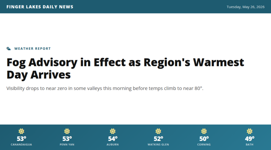
Evenings stay mild, with temperatures easing through the 60s after sunset. Overnight lows settle back into the low 50s under clear skies.
Looking ahead: Wednesday stays warm — mid to upper 70s — but a cold front approaching from the north brings a low chance of showers and thunderstorms by Wednesday evening. Cooler and unsettled conditions are expected to follow through the holiday weekend, so enjoy today while it lasts. A wetter pattern may persist into early next week.
Weather Center forecast for the Finger Lakes region. Sourced from NWS, Open-Meteo, NWS Area Forecast Discussion, and USGS stream-flow data. Updated 6 AM, noon, and 6 PM ET.